



Hillary Step Everest: History, Location, Height and Everything You Need to Know
03 September 2026
By admin
It is impossible not to think of Hillary Step when asked to name an Everest location about which everyone speaks. This narrow rock path is located close to the summit and has become an iconic feature of Mount Everest.
The term is derived from the name of Sir Edmund Hillary who together with Tenzing Norgay successfully passed through this rock face in 1953 and became the first people to conquer Everest. Just one passage gave the Step the historical status which it has had ever since.
Hillary Step Everest is located at 8,790 meters above sea level, just a few meters away from the summit ridge. For decades, it remained the last obstacle for climbers who tried to ascend Everest. It was well-known and respected among mountaineers due to its dangerous ledge and rocky face as well because of long lines forming here in the climbing season.
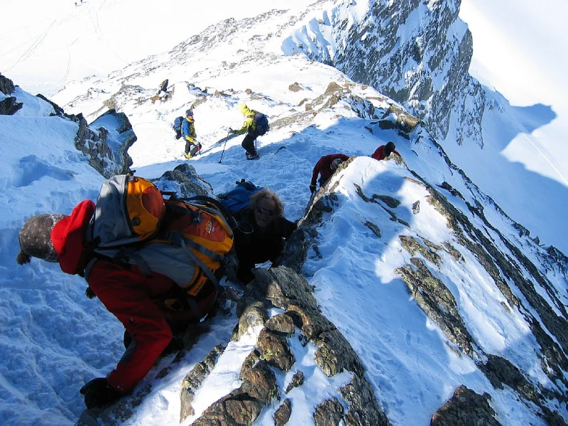
But then came 2015. An earthquake happened in Nepal, and this event affected the Hillary Step in such a way that even nowadays people discuss it. According to some mountaineering professionals, the rock itself was destroyed and moved. However, there are those who claim that just got covered with more snow. Whatever the case, the Hillary Step doesn’t look like it used to anymore.
And so, why is this little strip of rock so important? The reason for that is the location of this part – it is situated right at the very limit of the death zone.
In this blog, we will trace the entire history of Hillary Step Everest Route. You will find out about its exact location on the mountain, about its height, what has been changed after the earthquake, why it was named like this and many other interesting facts about this legendary route.
Why Is It Called the Hillary Step?
The reason it is called the Hillary Step lies in a single ascent from history. On 29 May 1953, Sir Edmund Hillary and Tenzing Norgay found themselves faced with a sheer rock face not far from the summit of Everest. Never before had anyone scaled such heights.
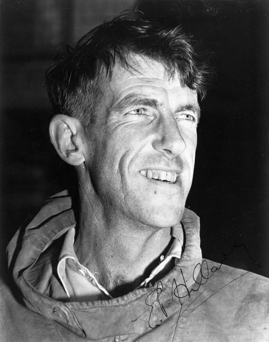
It was Hillary who made the ascent through this rock band. It was not an easy task even for the experienced mountaineer as he had to make his way up the rock face using a crack between it and the ice by using his sheer strength. Tenzing Norway was not far behind him and together, the two men cleared the final obstacle blocking their ascent to the top. Shortly after, these men became the first people to conquer Mount Everest.
News of this achievement quickly reached around the world, and climbers and reporters were eager to learn every detail about the conquest of Everest, including details regarding the final rock band. Eventually, it became practice to call that path “Hillary Step” in honor of the person who found a way to get past it.
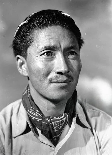
The name of Tenzing Norgay may not be associated with this particular feature, but his contribution to the climb is of equal importance. If it had not been for him and his skills, Hillary would have never reached the summit. This is precisely why Hillary Step Everest is such an important place in mountaineering history. This is not just some rocky formation; it symbolizes the moment when two men from entirely different worlds managed to accomplish what everyone thought was impossible.
To this day, anyone who conquers the Hillary Step Everest, follows the footprints of the first climbers.
Where is the Hillary Step Located?
The Hillary Step is a high point of Mount Everest, on the Southeast Ridge. It is the last part of South Col route, which was taken by the same duo in 1953. This rock band lies at an altitude of 8,790 meter, right before reaching the peak. It lies between two significant points: the South Summit and the actual summit of Mount Everest. The climbers have to go through it while approaching the summit.
The Hillary Step Mount Everest route belongs to the Nepalese side of the mountain. This is the popular side of Mount Everest, in comparison to the Tibet or northern side of the mountain. That is why many commercial expeditions prefer it, because it is better established and there are better logistics on it.
In order to get an idea about where the Hillary Step is located, let’s look at the whole climbing route:
Base Camp -> Camp I -> Camp II -> Camp III -> Camp IV (South Col) -> The Balcony -> South Summit -> Hillary Step -> Everest Summit.
Every one of these stages has its difficulties, but passing the Hillary Step means overcoming one more psychological barrier because after passing it climbers get the impression that the peak is quite reachable.
Although the distance between two rocks is quite short, it can be covered only in a few meters of exposed rocks and ice, it has some specific features making it much harder than any other one. Firstly, its location is at the border of the death zone. Secondly, its thin air and cold temperatures and thirdly, the steep slopes on both sides of it make it difficult even for experienced climbers.
It is precisely because of this particular location that makes the Hillary Step Everest route crucial in the climbing history of Everest.
Why Was the Hillary Step So Difficult to Climb?
At first glance, the Hillary Step doesn’t look like a challenge because it’s a rock wall about 12 meters high and climbers can easily climb such heights.
But there is nothing easy about climbing Everest. Everything becomes difficult at an altitude of 8,000 meters, and that’s exactly where this challenge lies. The rock face is quite steep and, in some areas, nearly vertical. The climbers have to be able to locate footholds on narrow ledges, even when wearing heavy boots and crampons. One misstep and there is no margin of safety on both sides of the ledge.
Altitude makes everything extremely challenging. Here, the availability of oxygen in the air is one-third of what is present at lower level. Every physical movement requires tremendous effort because of the lack of oxygen. And the strong winds make the climb even more challenging, since they can knock any climber from their balance on a narrow and exposed route.
The space is limited in this case, as the Step provides room enough for only one climber at once. It means that when an ascending climber meets a descending one, one of them has to stop for a couple of minutes hanging on the cliff. At this stage, climbers are already tired because they have been ascending for many hours, even days. At this altitude, fatigue hits really quickly, making muscles weaker and thinking slower.
This is what made the Hillary Step route such a difficult Everest climb. This route was not only about ascending a rock face; it was about doing with tired body, low oxygen, and in exposed area, one of the most dangerous places of the whole mountain.
Is the Hillary Step Still There?
This is a very common question, and unfortunately, there is no single answer. The thing is that some changes took place, but there is not a clear understanding of what happened.
Before 2015, the Hillary Step was very similar to how it was during Hillary and Tenzing times. This was the rock wall that was around 12 meters high and located below the summit ridge.
In April 2015, there was a huge earthquake in Nepal. As a result, avalanches struck the area of Mount Everest and the mountain itself. And the climbers, who visited Mount Everest after this event, noticed some changes.
While some Sherpas and mountaineers who were already familiar with this place reported that a significant part of the rock wall shifted or collapsed, others claimed that the reason for changes was the snow accumulation, than the disappearance of the rock.
As you can see, there is no single version of events, and it is difficult to determine what really happened.
We can be sure that the Hillary Step on the Everest route today looks somewhat differently than it did in the past. For some people, it looks smaller. For others, it has a snow-covered slope that replaces the difficult rocky climb.
It is this very reason why old reports and new climbing stories do not always match. When a climber describes the Hillary Step after having been there on the expedition in 2010, he/she sounds like speaking about an absolutely different point than a person who has been there in 2019 and later.
There is, one thing that has not changed about the Hillary Step – it has remained one of the most challenging areas of the world. No matter what form it takes each season, the Hillary Step remains the point on the way to Everest summit that is to be respected.
How Climbers Cross the Hillary Step Everest Route
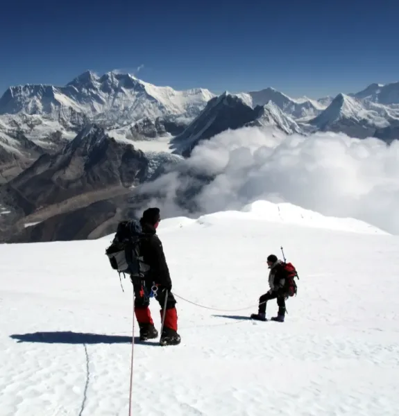
Once the climbers have passed the South Summit, they begin climbing the narrow Southeast Ridge. This is where the Hillary Step can be seen; it is one of the last major climbs before reaching the summit.
Almost all the expeditions depend on the use of the fixed ropes in this area. These fixed ropes are put up by the Sherpas earlier in the year to give the climbers something safe to clip into.
The crossing of the Step requires deliberate actions from the climbers. They step slowly and deliberately with their feet and ensure that they are standing steadily before putting their body weight on it.
The climbers proceed to the summit ridge after passing the Step, and it becomes clear that they will soon reach the summit of the Everest. This seems to be quite an easy process in theory. But the summit day does not go that easily.
The Hillary Step Everest route allows only one climber to pass at a time. If too many people try to summit on the same day, long queues are formed at that point. The waiting time can reach half an hour or even longer.
Such delay can bring heavy consequences. In addition to the loss of valuable oxygen supplies, cold will come faster, which increases the probability of getting frostbite in case there is no place to hide or move somewhere.
It was due to such traffic jams that became safety hazards during crowded seasons that made it a matter of global importance regarding overcrowding of Mount Everest. This is why the Hillary Step Everest route attracts so much attention nowadays.
Can EBC Trekking Tourist See the Hillary Step Everest?
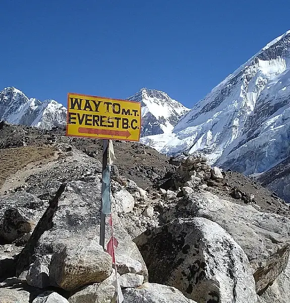
For those planning to undertake a trek to Everest Base Camp thing that should be cleared out right away is that you will not get to see the Hillary Step while on the expedition. This is because the Hillary Step Everest lies much higher than the Base Camp, and it lies in a totally different area of the mountain.
The elevation at the Base Camp is about 5,364 meters while the Hillary Step is found at an altitude of almost 8,790 meters along the climbing trail to the summit. This huge difference not only lies in terms of altitude but also the type of skills needed.
It is crucial that anyone doing the research on the Hillary Step Everest route understands this difference, as trekking to the Base Camp and climbing the summit of Everest are two totally different adventures, even if they both are connected to the same mountain.
Still, being on Base Camp is amazing. You are surrounded by the Khumbu Icefall, glaciers, and the surrounding mountains that have made this place famous. There is no way to see the Hillary Step, but you will surely feel its greatness and history.
Frequently Asked Questions About Hillary Step
Where is Hillary Step?
Hillary Step is found on the southeast ridge of Mount Everest, near the South Col route, between the South Summit and the peak itself.
How tall is Hillary Step?
Hillary Step is at an elevation of about 8,790 meters from the surface of the earth, below Everest summit.
Does Hillary Step still exist?
Yes. It still exists, although the structure might not be the same as it used to be due to the 2015 earthquake.
Can I see Hillary Step on the Everest Base Camp Trek?
No. The Hillary Step can be seen only high above the Base Camp on the route used by mountaineers for ascending.
Who Climbed Hillary Step First?
Sir Edmund Hillary and Tenzing Norgay were the first people to ascend this part of Everest in 1953.
Is Hillary Step easy to climb?
No, Hillary Step is hard to climb because of the steep rock and other factors such as altitude and lack of oxygen.
Why is it called Hillary Step?
Hillary Step was named in honor of Sir Edmund Hillary who along with his fellow mountaineer, Tenzing Norgay, climbed this rock formation in 1953.
What happens to Hillary Step after the 2015 earthquake?
A few reports say that there have been changes to the rock formation, but some sources contradict each other.

Table of Contents
- Why Is It Called the Hillary Step?
- Where is the Hillary Step Located?
- Why Was the Hillary Step So Difficult to Climb?
- Is the Hillary Step Still There?
- How Climbers Cross the Hillary Step Everest Route
- Can EBC Trekking Tourist See the Hillary Step Everest?
- Frequently Asked Questions About Hillary Step